Per-and polyfluoroalkyl substances (PFAS) are ubiquitous, potentially pose health concerns, and are challenging to clean up. But Terradex’s LandWatch solution can detect potential risks and alert parties to PFAS contamination before any potential exposure occurs.
An industrial client that uses PFAS compounds in its manufacturing process utilizes LandWatch to proactively ensure that nearby residents are aware of potential exposure to PFAS compounds. LandWatch monitors land and water activity on 700,000 parcels of land (across multiple counties), making it possible to identify potential PFAS exposure pathways and alert affected stakeholders.
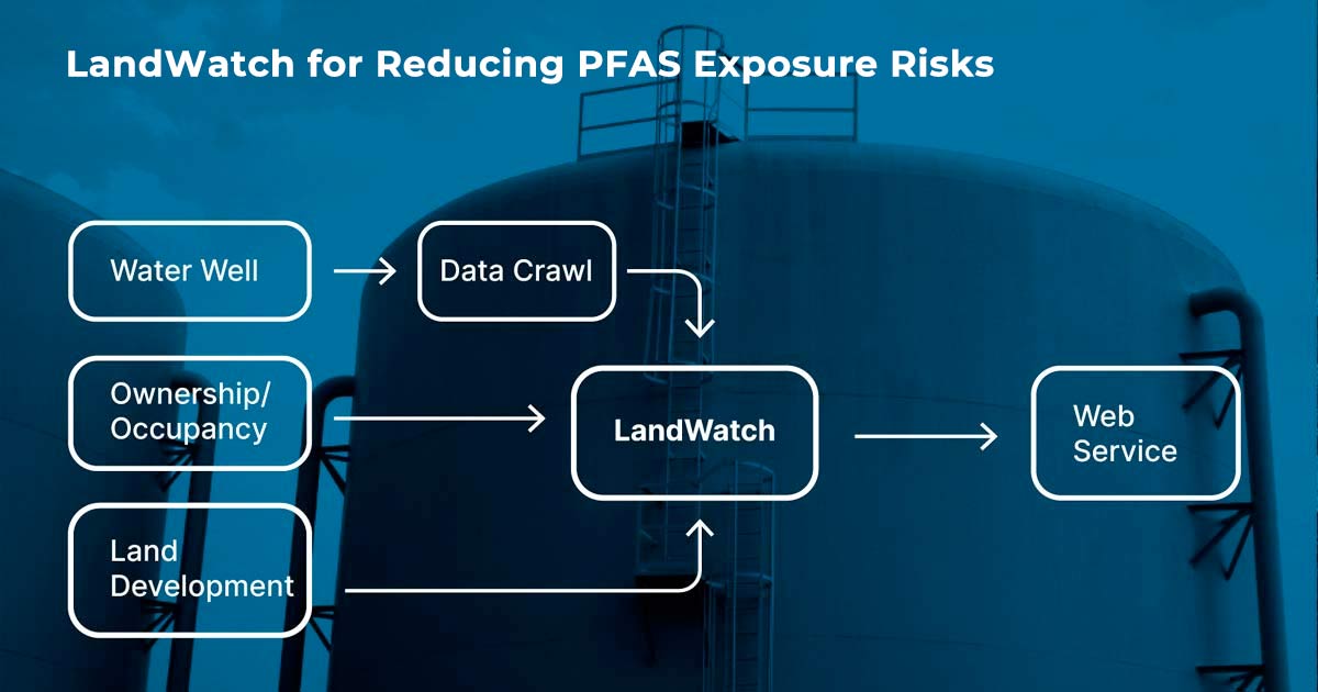
Terradex monitors building activities associated with potential PFAS exposure, looking specifically for new parcel ownership or occupancy and new water well permitting. Our strategy is event-driven. For example, when someone moves into a trailer park located on the relevant parcels, our monitoring can detect the installation of a shallow drinking water well not directly connected to the city water supply. The client could then communicate to the potentially affected party if PFAS has been detected in the water supply.
Collecting water well data from the state agency website has been challenging. To address this potential roadblock, Terradex built a data crawl that searched through millions of water well installation reports, each on separate web pages, to capture water well locations and descriptions. A data crawl is a web automation tool that when applied to this project builds a catalog of wells, then continuously searches for any new or destroyed water wells. The well list is filtered to the project boundaries and delivered to the client as a web service that integrates with their larger project management mapping system.
This is an innovative adaptation of LandWatch, where we work with a consulting partner who consumes the data we gather as a part of a more extensive site risk management program. Collecting this data at scale is challenging, but our web data service has been generating monthly reports measuring the number of new property sales, building permits, occupants, and water wells for the past two years.